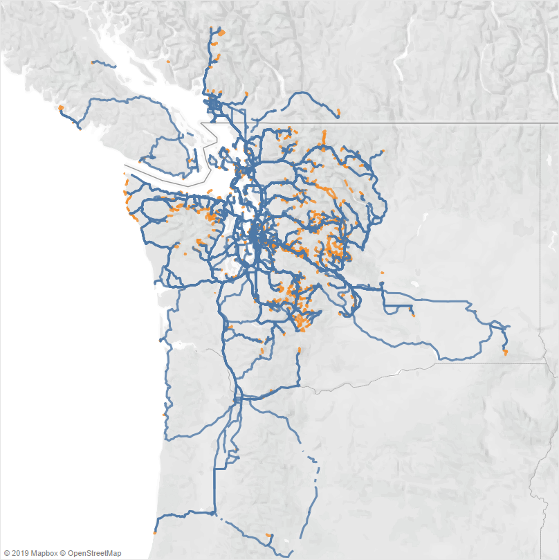
This map shows every tracklog I recorded while driving and hiking around the Pacific Northwest over the past ten years. The blue tracks were recorded while driving, and the orange tracks while hiking, paddling, or skiing.
How?
Currently, I use a Garmin Oregon 450 to record most of the outdoor activities, and Automatic for driving. Using a phone for tracking is still too much of a trade-off between draining the battery and accuracy for me, especially for longer activities.
Automatic exports spreadsheets, from which GPX files can be extracted. Together with the GPX files copied off the Garmin device, these files can be converted to GeoJSON, which can be imported into and visualized in Tableau Public.